Author Archives: admin

Racing Roundup – Chasing Hills and Podiums

In the past few weeks and months I have been busy racing duathlons, getting back into Scottish XC, trying my hand at a bit more road racing and chasing hills. As I am keen to avoid too many words about my mediocre racing here, you will find a couple of reports of my efforts in the Fastafarian colours of Velo Club Moulin (along with the interesting exploits of the other riders) on the club blog.

More Scottish National Trail write-ups coming soon. In the meantime, keep it rubber side down (except where appropriate) and enjoy the dust while it lasts.

The Scottish National Trail: Part 3 – Slateford to Milngavie

As the end of 2013 approaches, it recently dawned on me that my limited miles (a single day in March) on the Scottish National Trail was a poor show, and so with Christmas turkey still weighing me down, I found time to ride the “easy” Slateford to Milngavie section (which I am labelling as “Part 3”, Peebles to Slateford having been “Part 2“, and “Part 1” still to be ridden).

In between 40mph winds and torrential downpours, the forecast suggested a couple of dry days. Boxing Day looked tempting, but the need to rely on my long suffering wife’s taxi services (in the absence of a Scotrail service) saw me delaying slightly to 29 December. Probably a wise move as I’m quite sure I’ll be cashing in lots of brownie points for her taxi services for other sections.

Whilst I intend to ride the mountain bike for the rest of the trail, the Slateford to Milngavie section is along the flat and relatively smooth Union and Forth and Clyde Canal paths for the most part, and so the lighter cyclocross bike with skinnier tyres seemed the better option. Having ridden to Linlithgow in early January before, I know how wet the canal towpaths can be, even on dry days, and so the Shimano waterproof boots were donned and the rear mudguard added to the bike.

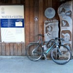
The Slateford start is only a couple of miles from home (I pass the Scottish National Trail plaque at the Water of Leith visitor centre almost daily on my cycle to work as a constant reminder of my dilatoriness), so after a quick ride down the hill and the obligatory start photo shot, I was climbing the steps onto the Union Canal path.

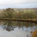
The relative simplicity of this section of the trail means that I can keep the route description brief. The Union Canal allowed a brisk start, and although the prevailing westerly wind provided a bit of resistance, this day would be by far the flattest of the trail, and ideal for weary legs after a hard season of cyclocross racing and a long lingering cold. The section to Ratho was quickly dispatched, before the towpath began to resemble more of a cyclocross racecourse – skinny cyclocross tyres cutting through a sodden mulch of rotting leaves and mud. The plywood childrens’ television characters lining the banks towards Newbridge kept a colourful, if slightly menacing eye on my progress before the trail opened out on to more exposed sections through Winchburgh and Broxburn, where the leafy mulch was replaced by puddle after puddle and a slightly stronger headwind.

The flattest ride you will ever see? The lumpiest bits are actually before and after the proper Scottish National Trail sections.

The flattest ride you will ever see? The lumpiest bits are actually before and after the proper Scottish National Trail sections.

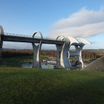
The flat nature of the route reflects the impressive engineering involved – there is just a single lock between Edinburgh and the canal end by Falkirk. I always wonder if engineering like this would be undertaken nowadays – I’m sure it would be voted down by some quango as too expensive and not worth the bother. The tunnel a couple of miles before the Falkirk wheel is no less impressive, with jagged bare rock still visible on the roof and now well illuminated. Shortly afterwards the shiny and relatively new Falkirk wheel looms into view, alongside the only descent on the canal part of the route. The last time I visited here by bike was when at university in Glasgow – riding home with a friend was good way to avoid the Scotrail and Citylink fares, although we probably spent more than that in extra mars bars along the way. It was definitely a bit warmer then.

Pressing on past pedestrians staggering around the path, the route continues along the Forth and Clyde Canal towards Glasgow on wider but similarly puddly paths. By now the dog walkers were out in slightly greater numbers, and I was glad I had added the bell to the cyclocross bike. Ting ting.

By the time I approached Cadder, I was growing weary of the long, flat miles and relentless (but thankfully not terribly strong) headwind, and was glad to turn off on to the road for a short climb up past the church and descent towards Cawder Golf Club. A brief wrong turn saw me heading along a tempting driveway towards the clubhouse before about turning and picking up the path through a line of trees that I should have seen the first time around.

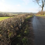
After cutting through the village of Balmore, I continued over the second golf course – sneaking round the clubhouse and on to a good path. At separate points I passed two groundsmen – both exchanged brief pleasantries and neither seemed perturbed by a mucky cyclocrosser nipping round the course – right to roam working well in practice. The path through the club was relatively easy to follow (although not signposted, so I was glad of my Garmin mapping) and aside from cutting across a deserted fairway, followed a path which would trouble only the most wayward tee shot. From here, pleasant backroads (through Baldernock and a third golf course in as many miles – they love lairy polo necks, checked trousers and Jaguars in East Dunbartonshire) led onwards and down into Milngavie. Thankfully I followed a car through the fast flowing ford on Baldernock Road. I might otherwise have been tempted to power through, but going arse over tit on slippy cobbles in the final mile would have been an embarrassing way to finish the day.

Having briefly flirted with the idea of picking up the canal again near Kirkintilloch and riding home (making a 110mi round trip), I decided not to spoil a pleasant enough ride by turning it into a do-able but slightly wearing epic. Shunning the tempting tailwind back along the canal, I pedalled down the Kelvin Walkway and on to Glasgow Queen Street for a train back to Edinburgh. Just over 100km all in, confirmed by the muddy spray covering bike and legs. I’m sure the virtually empty carriage at my end of the train was nothing to do with that though.

All done, a pleasant day of riding, although I am looking forward to the more rugged sections more. The prevailing wind was never quite strong enough to make me wish I had ridden west to east (which seems sensible, but not quite in the spirit of the SNT) and the canal miles were easily ticked off. I was slightly unsure what to expect of the sections through golf courses, but all were walker friendly and posed no issues for considerate cyclocrossers either.

A paltry two days of riding on the Scottish National Trail in 2013, but I’m now itching to crack on in 2014. I will let the trails dry out a bit first, and hopefully tick off several days in March, April and May. Not least, Part 1 from Kirk Yetholm still needs tackled.

The trimmed down GPX file, showing only the part of the ride from Slateford to Milngavie is here.

The Scottish National Trail: Part 2 – Peebles to Slateford

I like having a bike project on the go. Something to look forward to. Something to take up time when I should be working and to ponder whenever glancing idling at the calendar. Recently, meticulously planned new bike builds with geeky spreadsheets have filled much of that time, but now that the FF29 is built, the singlespeed CX bike is re-modelled and a few other bits and pieces have been upgraded, it is time to put the materialistic part of me to one side and get on and ride the damn things.

The current itch and long running project is to ride the Scottish National Trail. I am writing this post over a year after Cameron McNeish’s route launch, and almost a year after BBC’s Adventure Show covered the route. Although it was always to be a long term plan, progress has been rather slow.

To date, I have spent multiple evenings poring over OS maps (on paper and in Garmin BaseCamp), often with Cameron’s book as a handy reference for his suggested route. In riding terms, sadly only one day has been undertaken thus far, and whilst I had intended to write that up after riding a few sections, I had better press on before my hazy memories disappear forever.

Getting my route planning on

More on the route in later posts, but the basic premise in creating the trail was a trail for walkers running the length of Scotland using existing routes and tracks. Whether it will all be suitable for riding remains to be seen and I suspect that a few sections might require a bit of a rethink. The trail runs from Kirk Yetholm in the Scottish Borders, to Cape Wrath in the far north west. The appeal for me lies in exploring new trails and more than that, new areas. I have never ventured to areas such as Torridon, never visited Kirk Yetholm and never been much further north that Ullapool and Inchnadamph. Even in areas I have visited, there will be new paths I have never stumbled across.

Peebles to Slateford

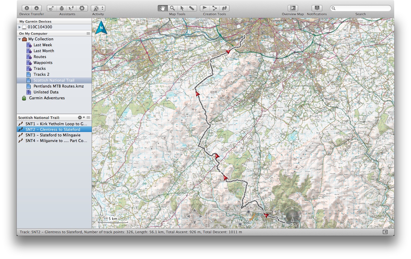
Foregoing the intended first “stage” from Kirk Yetholm to Peebles (I am breaking it down into day sized chunks for mountain biking) , I instead began the second leg from Glentress to Slateford on a chilly but sunny early March day. Logistically, this worked well – a bimble around Glentress with friends in the morning, a spot of lunch in the cafe and then a solo ride home via Slateford (handily only a mile or two from home). Although not the proper first stage, this would include a neat finish by the trail’s plaque at the Water of Leith centre in Slateford (oddly lying neither at the start nor the finish of the official route, but 80 miles in). Presumably Alex Salmond could not be persuaded to get his wellies muddy in Kirk Yetholm or Cape Wrath when unveiling the plaque.

After a gentle start along the river from Glentress towards Peebles, the route soon turned uphill out of Peebles onto Hamilton Hill – already a new hill and path to me. The early afternoon sun had me down to shorts and top on only the 2nd of March, which was probably a bit ambitious (I was layering up again half an hour later). For the most part the tracks were good, although became a bit indistinct as I waded through farmyard mud by Upper Kidston Farm on my way to the Meldons. Briefly dropping down to the minor road from Eddleston (a favourite of mine on the road bike), the tarmac is short lived, giving way to a firebreak track and eventually an open climb round Drum Maw and down to Romano Bridge. Avoiding the obvious minor road (as the route often does, sometimes frustratingly) I added a bit of distance and fair amount of time skirting through farmland before eventually joining the very same minor road for the run into West Linton and on to more familiar trails – the Roman Road which connects West Linton to Carlops – a handy link for anyone mountain biking in the Pentlands. Very good of those Romans.

From here, I knew I could look forward to a stiff climb on a good track to North Esk Reservoir and then an often muddy track up to the Bore Stane. There are various trails in the Pentlands I only ride when bone dry and this is one such trail. Thankfully February had been relatively dry and the trail was mostly rideable with just a few dabs and a little wheel spinning. Over the top and on to  “Xylophone”: an inviting looking path, but made from a long line of greasy, polished logs placed side by side for a few kilometres. Polished logs lead to bum notes in the wet so I generally used the peaty singletrack to the side where available. Down to Listonshiels and avoiding the fast road down to Balerno I slogged through the slightly boggy “path” (sheep track is probably more accurate these days) towards West Rigg before a spin through Balerno to clean the tyres on the road (mostly in my face) and on to the Water of Leith walkway to Slateford. 4 hours 40 minutes after leaving Glentress was a reasonable ride – the time not helped by various stop to add layers, remove layers, add layers again, and a few short detours through muddy fields trying to find paths through farms.

A good start to the trail – 99% rideable, some new trails, some old friends, and not a drop of rain. Now, about that first leg…

The GPX for my “Part 2” from Glentress to Slateford can be found here.

The South Downs Way

The South Downs Way has become something of a classic in British mountain biking, particularly for the “double” efforts of a number of ultra fit endurance riders in the South. For that reason, plenty has been written about the route in the past, and so only a few short words are probably justified here.

SDW-Map


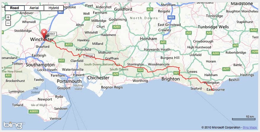
Originally intending to ride West to East (as is probably more common), a relentless north easterly wind in early April 2013 saw me changing my plans and hopping on a (very) early morning train to London, and onwards to Eastbourne. I rolled up to the start line and up the aptly named first climb at “Warren Hill” in temperatures of about 2 degrees and glorious sunshine which lasted for all of 20 minutes before it became cloudy but reasonably bright for the rest of the day.

XCPro3 on the South Downs Way

Not being terribly familiar with the route, I had downloaded a GPX file from southdownsdouble.net which I stuck on my Garmin 800 to keep me on route. This was not really essential, but did prove quite handy a couple of times for alerting me when I had my head down and overshot a junction. At least the angry “chirp” from the Garmin saved me from descending too far down the wrong track. The route linked to above diverged slightly from the current waymarked route in the final third, but I stuck with the GPX route to follow the tracks of dozens of riders before me. I had no real ambitions for a fast time – I knew I would still be some way off of any records, so settled for aiming to finish in daylight and enjoying the ride.

The relentless north easterly wind was a mixed blessing. A week of dry weather and strong winds had meant that the dreaded wet clay was dry and fast and on the whole, and the wind was more behind me than in front of me. A constant wind is quite wearing though, and being a side wind really, it wasn’t all plain sailing. I recall pedalling ridiculously hard down one north easterly facing descent which looked like it should be much faster than it was, and a few gruelling climbs which were a bit more into the headwind than I would have liked. I shouldn’t complain though – I passed walkers at one point with hoods up and heads down so low to shelter from the wind that despite walking towards me up an open hillside, they didn’t spot me until I gave them a cheery hello when passing. That certainly woke them up.

The route on the whole was fairly pleasant – good open views for much of the route, completely rideable climbs and, being a weekday, not too many walkers to slow down for. The route profile suggested bigger climbs in the first half, with a slightly flatter section higher up the ridge on the final half before the run down to Winchester. I told myself that a few times in the first half, trying to convince myself that the second half would be faster. By the time I was on to the last third, I kept telling myself that “surely this is the last notable climb”? In looking at the route before hand, I had clearly missed Butser Hill, which at that point in the ride can be best described as a big grassy wall. Granny ring engaged, I was satisfied just getting up it without wobbling to a standstill.

SDW-Elevation

After that last serious climb, I pedalled squares over every little rise thinking “I’ll be able to see Winchester from the other side of here”. That became a bit of a hollow sentiment after half a dozen such climbs though, and I was glad to eventually find some fast, smooth roads to roll towards Winchester on.

Overall a great day out, but a few headwind sections took a bit more out of me than I had expected. I rolled up to the statue in Winchester after a little over 11 hours and just under 100 miles, technically after sunset, but still not dark enough to merit my proper bike light. Job done.

I wonder if I would have been quicker on a 29er…

Bowhill Offroad Duathlon Series

Whilst I do not intend for this page to be a summary of every race I enter, I thought that a few brief words about the Bowhill Duathlon Series might be in order.

I first entered the Glentress Duathlon Series a few years ago to try something a bit different, and to keep ticking over in winter. Friends who had entered previously encouraged me along, citing relaxed racing in a fun atmosphere. Although not a runner by any stretch of the imagination, I managed a short run once a week over winter and enjoyed doing something different.

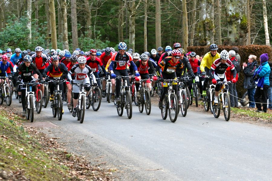
For 2013, Glentress Duathlon organisers Pete and Elsie stepped back from the series, and Durty Events took up the mantle. A change of venue from Glentress to Bowhill Estate followed (as a result of onerous terms being applied by the Forestry Commission at Glentress I believe) but thankfully the same large field (around 150 people entered) and lighthearted atmosphere de-camped down the road to Selkirk.

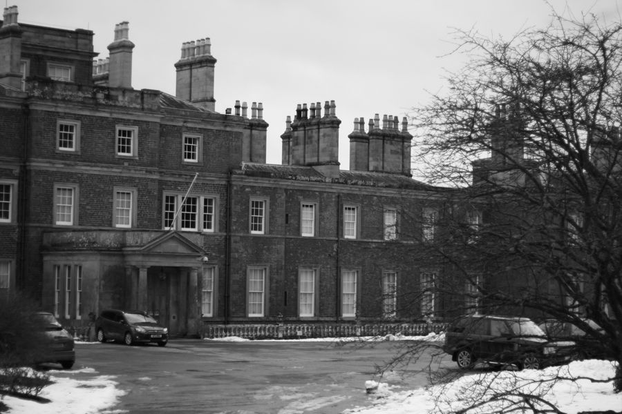
Bowhill provides a great backdrop

Round 1 – Short

The first (short) race was set on a bright but cold day in December. Temperatures of around -5 made for interesting conditions on the short tarmac sections of the course –  ideal for showing off my best bambi impression but not great for running. I plodded round the 5k run and undoubtedly lost a bit of time by being too cautious on the ice, before jumping on the bike. Run followed by bike probably suits me as I can take my time on the run and push on the bike, knowing that I can ride harder than I can run. I managed to catch and pass a good number of other riders through the woods and on the firetrack sections and was pleasantly surprised to cross the line in 4th overall behind a relay pair and a Veteran racer, so 2nd in category (senior male).


Round 2 – Medium

The second (medium) round was held in equally challenging conditions. After a week of heavy snow showers, the temperature rose in the days leading up to the race, leaving a mix of deep slushy snow and axle deep snow melt puddles. The medium was billed as a 30min bike section followed by a run of a similar duration. A rather worn Racing Ralph rear tyre which I had been running for the best part of a year was not ideal climbing on slush, and after staying with the leaders initially, I was soon spinning the back tyre and lost contact. I plodded round at a reasonable pace, with a fairly useless rear brake preventing me from taking too many risks in the twisty bits, and a lack of time on the mountain bike meaning that I could definitely have done better in the rutted firetracks. I was caught near the end by another rider, although as he was in a relay team I decided not to race him, and followed closely into transition. A steady plod round the run saw me quickly pass the mixed team runner and I was told soon after by a marshal that I was second. I could see the third place runner gaining on me for much of the run, but I held him off to finish 2nd overall, and 2nd solo senior once again. It turned out that the vet rider who had led after the bike had missed a turn on the run and added substantially to his time. I suspect he (name not typed to save the embarrassment!) is still kicking himself.

IMG_2224


Race 3 – Long

After the Race 1 winner (Rory Downie) had not attended Race 2, and the Race 2 winner (Kie Jackson) having missed Race 1, I was the surprise series leader going into the final round. Following a glorious week of dry February weather, I was hopeful that my bald rear tyre might prove to be an advantage for once. The morning of the race suggested otherwise – I awoke to an inch of snow in Bonaly and uncleared roads in the area had me wondering whether I would even make it to the start line. A quick wheel change in the garage for a 1.8″ mud tyre on a tatty old wheel and I was off. Thankfully after crawling round the bypass in traffic at 20mph, the roads cleared, and by the time I arrived at Bowhill, the sun was out and there was not a flake of chaos powder to be seen. Having gotten a few more miles in on the bike in February than January, I was feeling a bit fresher and happily slotted into 2nd place on the long firetrack climb on the bike. Tapping out a steady tempo, my ambition was simply to stay with the leader as long as I could, knowing that I would not be able to hold on for the whole race, but also that the leader was a vet rider that I would not be racing. I stuck with the pace for about a third of the bike section, matching the little digs for a while before a ridiculously steep climb saw me drop off the pace and plod round on my own for a while. Again, the lack of mountain bike time told as I misjudged a few lines through muddy double track, and then jammed my chain on a sharp right hander leading from a descent straight into a climb. A couple of other riders caught me, but I kept a steady pace for the final section and came into transition in second.

Knowing that I would struggle on the 40min run if I pushed too hard, I took my time in transition, leaving in 4th, but soon catching a runner from a mixed team. The runner in 2nd was just ahead but was clearly a much keener runner than me and gradually pulled away. I knew I just had to hold off as many runners as I could, but one competitor flying past me as if I was standing still suggested that would be easier said than done. Missing a turn over a stream crossing did not help, adding 20 seconds and wet feet to my run, but after a steep run through the trees to the turning point and some banter with the marshall, I was happy to see on the return leg that the next competitor was not too close behind. The rough nature of the run through uncleared woods, jumping fallen trees suited me – taking my mind of the fact that I find running a bit of a slog. Returning towards the finish line I passed the vet rider who had led after the bike, and although the pass did not count for anything, I felt fresh and pressed on to the finish – 3rd overall and 3rd in category. The finish line sprint suggested that I should have pushed harder on the run, but after a 48min run, I doubt I would have been able to catch 2nd place 2 minutes ahead in any case.

IMG_2330

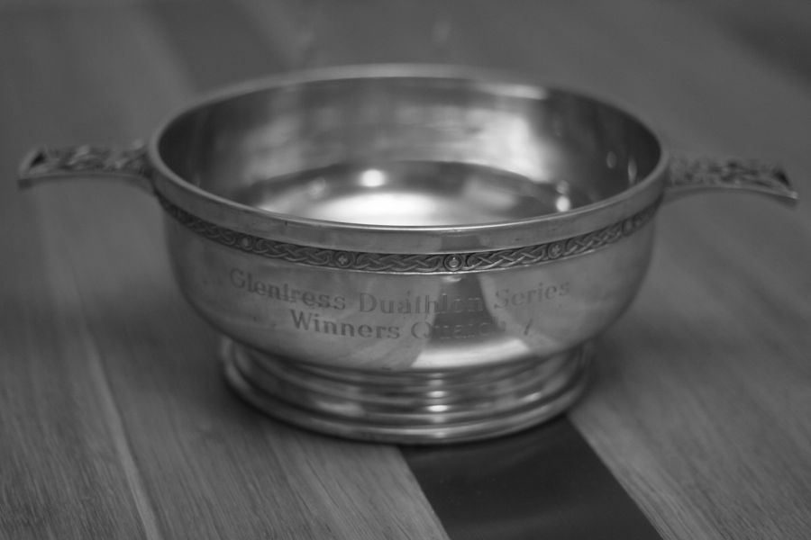
So despite not winning a round, two 2nd places and a 3rd was enough to comfortably take the series win. I am under no illusion that my running pace is some way off of the winners of each round, but it is good to be able to put in consistent efforts over winter. The mountain biking perhaps is not quite as grin inducing as the swoopy Glentress trails, but there was enough singletrack and close racing to keep it entertaining, and I even enjoyed the rough offroad nature of the run in the final round. Durty put a great effort into creating different courses for each round and I found the atmosphere relaxed with good laughs with other competitors before, after and sometimes during each race. If you fancy something a bit different to keep the fitness up over the winter, I would happily recommend a jaunt down to Bowhill in 2013/14. I’d recommend taking a rear tyre with some tread though.


IMG_2341


(Almost) The East Highland Way

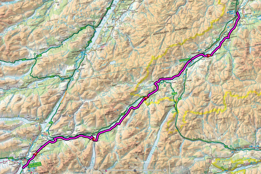
A recent discussion on this ride got me thinking about writing up a few words on riding the East Highland Way in “Spring” 2012 (more on that below), which might help anyone else looking to ride the route in future.
ehwplan

Having ridden the Great Glen Way between Fort William and Inverness a couple of times (once over 3 days as a student and again in a day more recently) I liked the idea of a big day on the mountain bike following trails that I might not otherwise ride. Whilst some might prefer to create their own route with more technical riding rather than riding a tame set trail, I find the latter attractive occasionally, as it is good to get the head down knowing that a rideable trail lies ahead, without having to think too much about following a complicated route through bogs.

The idea of the East Highland Way is to form a new long distance route (aimed at walkers) linking the end of the West Highland Way in Fort William with Aviemore in the central Highlands. Having looked at a few other long distance options, good train links at either end made this an attractive option – there is a handy 4.50am train from Edinburgh to Fort William which I used the previous year for the Great Glen Way. I knew short sections of the route and crucially it seemed to be mostly rideable.

The idea of riding the route was parked for a few months until some encouragement from Rob Lee to ride 1,000 miles in a month saw me finally getting a date in the diary. March 2012 was a glorious month with unseasonably high temperatures and sunny days. Unfortunately as the set date of 3rd April approached, there was a last throw of the dice for winter, with heavy snow forecast for much of Scotland overnight into the 3rd. Leaving the house at 4am I was treated to damp roads and sleet showers on the way to the train where I settled in for a good snooze. Waking up somewhere north of Glasgow I was greeted by the expected blanket of snow in the early light and was keen to get riding.
ehw2

East Highland Way – The Start


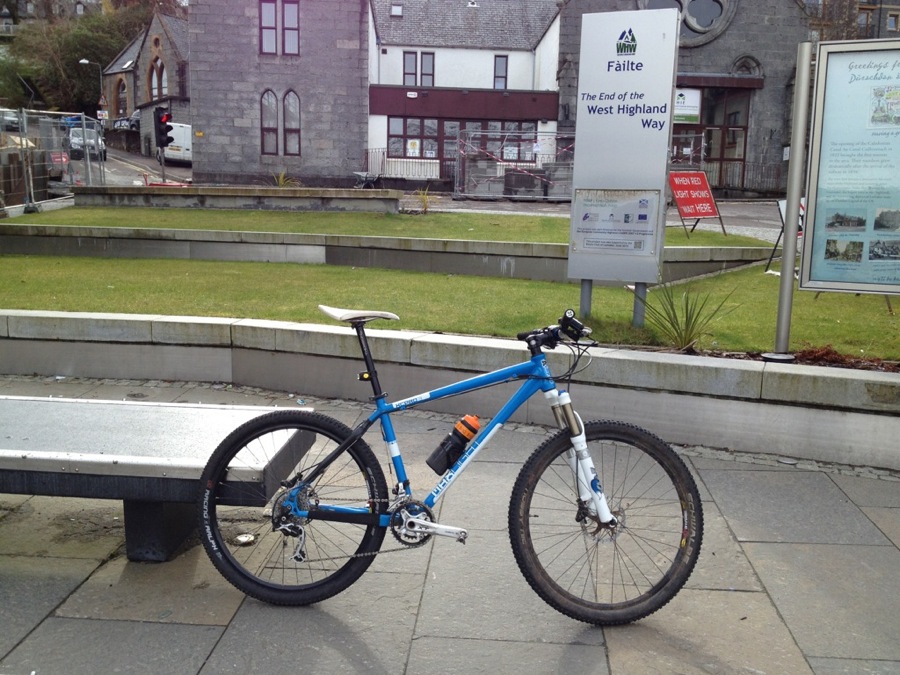
The start of the East Highland Way (which is not currently a waymarked route) is at the end of the West Highland Way so on stumbling off the train (and losing a rear light before I even started) I headed along to the end of the high street for the obligatory start photo. The first section through town was quite straightforward and then followed the cycle path alongside the A82 which will be familiar to anyone who has ever ridden up to Nevis Range.

I knew the section to Spean Bridge, having ridden it in reverse a couple of times so it was good to get some brisk miles in early on, leaving the tarmac cycle track and picking up a firetrack familiar to 10 Under the Ben riders before turning off onto a good doubletrack. A quick road section near Spean Bridge brought me into the village via a short offroad descent where I managed to snap a spoke before a coffee stop. Not quite going to plan, but at least the weather was good.
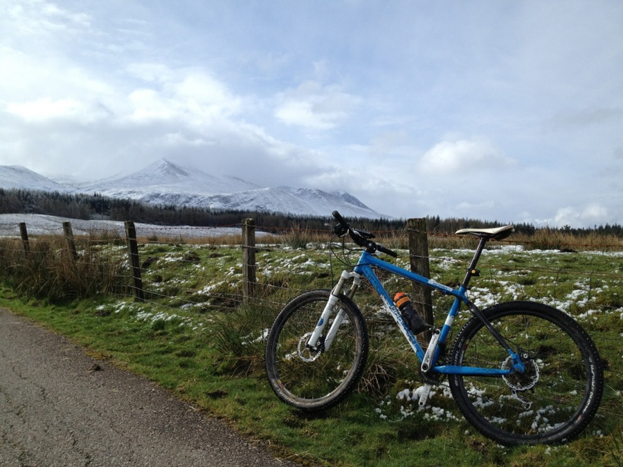
The XCPro3 against the stunning scenery

The XCPro3 against the stunning scenery

After a quick battery recharge (for both me and the phone I was using for route navigation) I set off on a good back road / dirt track towards Tulloch, following the River Spean. Eventually this petered out and I zig zagged round some bemused sheep through a damp field. Here a minor navigation fail saw me turning away from the river along a rough path when in hindsight I should have stayed with the river for a few hundred metres more. This error led to hopping a deer fence and dragging my bike through the trees up a vertical bank. Good exercise but it definitely added 15 minutes to the section and did nothing for my mood. Eventually I dragged myself to a clearing through the trees which led up to the firetrack shown on the OS map and I got the pedals turning again, slogging up a lumpy forestry road.

The next few miles were easier riding – wide forest tracks down towards the minor road through Fersit and then onto more good forest tracks in the woods above Loch Laggan. Eventually dropping down to the shore above Loch Laggan I was reminded of the reason for the unseasonably cold weather. When I planned this route I had high hopes for a nice prevailing south westerly behind me, on a route that goes in a pretty straight line north east. It wasn’t to be today though, and the few trees between the track and the shoreline did little to diminish the strength of the relentless headwind. Logging works near Ardverikie meant a brief detour back uphill and I was glad to drop down to the road by Inverpattack and out of the wind after a while.

Having wasted a bit of time with a broken spoke, a climb through the trees and a logging diversion I made my first decision to shun the track through the forest on the north of the A82 and head along the road in the sun for a bit and get to the warm coffee at Laggan Wolftrax a bit sooner. Or so I thought. It transpired that despite being the Easter break, the cafe at Laggan Wolftrax did not open on Tuesdays in early April. At the time of writing this, I understand that the Forestry Commission is considering developing the cafe / bike shop on site and the previous tenant, Base Camp Bikes has moved out, so the opening hours might be a bit different in future. At least the benches outside were in the sun, so I munched down a few bars before heading on, crossing the road and picking up a forest track and then a pleasant back road to Laggan.

Base Camp’s loss was my gain as the local shop in Laggan could not have been more pleasant. The owner was keen for me to warm up in a new waiting room they had opened for walkers across the road, but I put on a brave face and pretended the sun was warm, chatting to a few friendly walkers whom I had passed earlier and had now caught up with me.
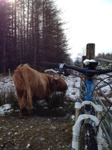
Meeting The Locals

Meeting The Locals

Checking the route on my phone and OS map, I noted that the cold temperatures meant that battery was dwindling fast and my average speed was a bit slower than I would have liked. Thinking of the train ticket I had booked home from Aviemore I decided to ride on the road for a section, shunning a 9mi off road section along the River Calder to Newtonmore in favour of a shorter 6mi road instead. In hindsight it turned out to be the best option – soon after leaving Laggan the north easterly wind blew in a relentless barrage of snow and hail to soak and chill me.

Briefly sheltering in Newtonmore, I decided to press on, following the East Highland Way along the road to Kingussie, and shunning the suggested option of an offroad section to the north. From here on in, the weather was a mix of pleasant sunshine in short bursts, interspersed with longer hail and snow showers. The route follows the National Cycle Network in part and the riding was easy. Crossing under the A9 the official route detours into the forest in parts, but with my phone now showing single digit battery life and checking the plotted route not being an option, I decided to stick on the the back roads past Loch Insh, Feshiebridge and on towards Aviemore, missing what I knew would be nice trails through the forest past Loch an Eilein.

Sadly with the phone battery fading fast (I had shunned carrying the SLR camera today) you will just have to take my word for it that the duvet like piles of snow lying at the side of a clear road in the fading evening sun made for a stunning view  – definitely made me glad that I had made the effort to get out, even if I was not really following the planned route.

Rolling into Aviemore at 7pm, 9 hours after leaving Fort William I realised that far from being late for my 8.30pm train as I had once feared, I had covered my 123km quickly enough to catch the preceding train. In hindsight, I probably could have taken a little more time to enjoy the forest trails instead of the last road section, but at the time, with freezing hail showers and dwindling phone battery, I had been in no mood to pull out the soggy OS maps.

So I haven’t really ridden the East Highland Way, but I have ridden from Fort William to Aviemore in the same rough direction, and probably using 80-85% of the suggested route. Would I recommend it? If you like a big day out on the bike with stunning scenery and easy riding then absolutely. Life would be dull if all rides were like that (there are no real technical sections), but it is great to get out for these big simple mile munchers a few times a year. All of the sections I used were 100% rideable (minor scrambling through trees due to a navigation error notwithstanding), and whilst the route guide suggests that there is one sections prone to flooding, the route as a whole is definitely suited to mountain biking, particular a fast rolling XC bike (dare I say a 29er?)

Would I do it again? Possibly. Although I generally consider that I have “done” the East Highland Way, writing this up, it still annoys me that I used more road than I would have liked, owing to the weather. Maybe one day I will do it again properly. If I do, it will be in 23°C March sunshine, rather than 0°C April hail though. For now though, I have other routes to ride. More on that soon.

The GPX route for my ride is here if you are interested in the rough route.